
Rare photos of my independently wealthy, recently converted rouler, and old college chum--et moi--early morning along the Frontage Rd.
Ryan was a good sport and came out early to Dog Mtn to tag along for my famous Owl Head Ranch Ride. Its a 70 mile trek from my place which circles the Tortolita Mtn Range. I can't believe that October is here, Gentle Readers, and we need arm warmers as its about 59 degrees this morning. Because I'm not having to drive, I get to sleep in a bit, make a pot of coffee for us, and throw the ball in the street for Callie.

The Frontage Rd is flat, with a tailwind heading up to Phoenix, and no traffic--time trial riders regularly spin out here.
From Dog Mtn, there's a very fast six mile descent down Tangerine to the Frontage Rd at I-10. We took this because I wanted Ryan to ride that part of the El Tour de Tucson course. After the 35 mph down hill through the brisk morning air, there's usually a strong tailwind heading West toward Phoenix--and it will push us to Park Link Rd, or about 22 miles, in no time at all.

Ryan has a GPS thing that he will plot the course with--if he can keep it from falling off the handle bars!

The water tank at Red Rock.
This is about all that's left of the town or Red Rock, that old water tank you see up there. 1918 flu epidemic put everyone to rest I think. We're on the old stage coach line, and then it was the rail line--and now Interstate 10. Back in the old days, it seems there was a town every 15 or 20 miles as the steam trains had to stop for water. This was the same in South Dakota where I went to University--about every 15 or so miles, the steam boats had to stop for fuel--wood--to keep the engines going. So towns like Vermillion and Yankton sprang up.

Trains are still rolling into Tucson. Engineers often wave and toot their horns as we ride past in the open desert.

Trains are still rolling into Tucson. Engineers often wave and toot their horns as we ride past in the open desert.

We make a stop--I take this photo for you--the sky and clouds make the light for taking photographs a bit tricky today.

Ryan holds on to my bike as I have to see a man about a horse.

Picacho Peak on the left--we're about to make our right turn onto Park Link Rd.
All the Randonneurs around here can tell you stories about Picacho Pass--first of all, you can see Picacho Peak from about 80 to 100 miles out in any direction. Its a check-point for Brevets, a place to get coffee on cold mornings, and often just in time for a water stop and food. There's a head wind that will suck the life out of you, and if you're lucky enough to be going the same direction as the tailwind, you will think you're Superman! This morning I promised Ryan a tailwind, and by golly 'twas with us!

Picaho Peak, I-10, and DQ.
If you click on the photo of the Peak for a larger image, you can see to the far right, the Picacho Peak Dairy Queen. There's a tower there with a steady blinking red light--and on brevets where you're headed South down into Saguaro Nat'l Park, on heading home in the late evening darkness to Casa Grande, the tower gives you a gauge to navigate by.

Looking East across the great desert to Mt. Lemmon.
If not for the tire tracks of a hunter's jeep, this is how the desert would have looked hundreds of years ago, before white people and before Father Kino rode horseback on this same road in the 1690's.

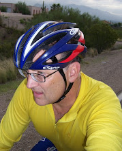
Not a photo of Father Kino, just me in my new Team Mooney jersey. Father Kino was Italian and he would be riding a Bianchi of course.
One thing about this ride which I like, is that at one point, you reach a section on the course where time seems to stand still--there is no sound--only the millions of saguaro reaching into the Fall sky. You look around, and you see Picacho Peak clearly with no interstate or clutter, as the Indians no doubt saw, and then you see Mt. Lemmon about 50 miles to the East, through a forest of saguaro.
If not for the tire tracks of a hunter's jeep, this is how the desert would have looked hundreds of years ago, before white people and before Father Kino rode horseback on this same road in the 1690's.

Not a photo of Father Kino, just me in my new Team Mooney jersey. Father Kino was Italian and he would be riding a Bianchi of course.
One thing about this ride which I like, is that at one point, you reach a section on the course where time seems to stand still--there is no sound--only the millions of saguaro reaching into the Fall sky. You look around, and you see Picacho Peak clearly with no interstate or clutter, as the Indians no doubt saw, and then you see Mt. Lemmon about 50 miles to the East, through a forest of saguaro.

Bees! Cool...
I have always wanted to have a bee hive in me back yard. I think I will someday. These bee hives are new and I want a photo. Ryan tells me that he is a bit wary of bees, so he rides up ahead. No sooner than I take this photo--watchful bees have arrived wanting to know what the hell I want, and they let me know that this is about as close as I'm going to get--so BUZZ OFF. Umm, okay like later bees...

The Regal Saguaro.
The rains this year were light--and the saguaros look a bit lean this Fall. Plus, Gentle Readers of This Blog, it was a hot and dry Summer.

The new chip seal on Park Link Rd has gotten smoother it seems.
As we're riding, the wind picks up and we have to push our way through a head wind--and there's a steady climb. I had thought about riding this 70 mile course the opposite way but I was hoping Ryan could benefit from riding parts of the El Tour course we'll both be on in November.

The Great Owl begins to appear! This is why we've ridden here today!
I believe the recently installed barbed-wire fence is to keep the cattle off the paved road now. This means that the area will most likely be developed for housing some day--but for now, it still remains quite pristine and ancient. I like to think that even the Indians that lived out here recognized that the rocks look like an owl's ear's coming out of the Earth. The Great Owl seems to rise up and his gaze follows you are you travel past.

It that cool or what?I believe the recently installed barbed-wire fence is to keep the cattle off the paved road now. This means that the area will most likely be developed for housing some day--but for now, it still remains quite pristine and ancient. I like to think that even the Indians that lived out here recognized that the rocks look like an owl's ear's coming out of the Earth. The Great Owl seems to rise up and his gaze follows you are you travel past.


Owl Head about three or four miles in the distance.

Time to get back to Dog Mtn.
Ryan and I both have early afternoon appointments to make, so we decide we'll get busy and push it home. But it has become gusty and now we have to do some moderate climbing.
Ryan and I both have early afternoon appointments to make, so we decide we'll get busy and push it home. But it has become gusty and now we have to do some moderate climbing.
I just want to say that Ryan is quite the strong rider, and I had to push to keep pace. I think we did well considering the climb and the headwind. At one point going back, I told Ryan about the 300 KM brevet I was on with Paul and Steve, Star of the Blog--and how we reached the snowline at one point in the climb where I joked there was a White Tiger. It was cold, the wind was brutal, and I was suffering. Paul and Steve pulled me up but I just wanted to stop and expire right there on Hwy 79. Well today, we took the climb head on and made good time. Ryan pulled some long stretches up for us.

This is from Ryan's GPS.
We made up for some lost time on the way back because, as you can see, we get the down hill for most of the way back. For the return trip, Gentle Readers of This Blog, there was tons of traffic--that is happening in Tucson and the area I'm afraid. At least we got to ride a twenty mile stretch with peace and serenity.
Cheers! Bruce
3 comments:
Nice that park link road is paved now. I wonder if it will ever be included in a Brevet?
I'm out of the brevet business due to physical limitations, but I was exactly thinking the same thing. Cut out Tom Mix and use Park Link for the 300K. If it rained it could be problem though, as I think Park Link floods, probably marks that off. The art of the river crossing while carrying a bike, I'll have to read up on that.
Bruce, that's a good NW loop. I was thinking doing it in reverse, but it would end with a climb on Tangerine, and I kind of prefer downhills at the end. But if it gets real cold, maybe that wouldn't be too bad, climb, descent, climb. Frontage & Park Link is the low point.
A great write-up. I must try this ride soon!
Post a Comment