 |
| Black Rock is an ancient volcano high on the Defiance Plateau |
With some warmer weather, but still a lot cold wind these days, I have not gone out on the road bike. Warm days melted the snow and muddy roads began to dry out. I need to be outside, Gentle Readers of This Blog - I planned to ride out to Black Rock this day, which I was told was about 5 or 7 miles ride. It turned out to be more like 12.
Rain and wind now seem to always be planning something - I've done the ride down to Canyon de Chelly, and this trip I wanted to see if I might take the road bike on some of these very hard-packed dirt roads. I figured I'd just go out a few miles and back - take my time.
 |
| Tsaile Lake, and Tsaile Peak |
Pretty quick, even on the Desert San Campus Bike, once I leave my place and The College, the world is big and wide open! I plan to ride out to the Peak, hide the bike, then hike and climb the Peak...
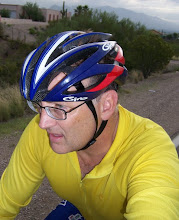
The Sun is bright and I need to protect my white skin these days. I'm not riding fast - should be wearing my helmet - but the locals know me by my straw hat. Little Egypt bought it for me, and well, it has become part of my persona I guess. But it keeps the Sun's rays from burning me, even at 7200 feet in the mountains. Anyway, back in Tucson, I got the worst sunburn in my life in February! Plus, this way I don't feel like I got to race or hurry.
 |
| Most Northern Boundary of Canyon de Chelly Nat'l Monument |
All the country is new and I want to know it - if I'm going to ride the road bike, I want to sense where I am by the feel and look of he mountains and trees, and the Sun and the feel and look of the road. Each mile has a different color and hardness - sometimes as you reach the pines, the air smells of a cool earthy dryness.
With the Desert San, it's pretty slow-going mes amis. I have to tell you I still have on the studded snow tires (from Lawrence, KS via Finland) and they roll heavy on the hard road. Mostly the road is bumpy and dry. I would not want to drive my car out here for sure as it would get beat all to Hell.
The few people that live out here probably drive as fast as they can without going out of control - probably just don't care. From their big four-wheel drive monster type trucks - that thick peanut-butter sticky mud seems to have flung everywhere to the sides of the road. Here's a sign asking to slow a bit going through here. "SLOW: Cows on the Road!"
Going out, the headwind I have is fierce! And I'm really sweating too because, I'm having to pretty much climb over a ridge. But as was reported to me, Black Rock is only five or six miles from The College I should see it soon!
I finally get over the ridge - looking on, I see more open road and I must be on top of one of the mesas out here. Road is mostly rough, but with the road bike and my 25 cm tires, I can probably roll pretty quick - the Desert San is heavy and like driving a tank. And I've seen no cars - so I could probably ride on the best part of the grooves if I have too.

I'm riding along the boundary of the Nat'l Park.
Old Hogans from times past start to appear out here. Looks like was good grazing for herds of sheep. But I have seen no sheep or cattle, and no people. There are power lines, and they look recent.
The wind is howling, but it doesn't have the cold sting like before.
As always, there will be wind, I'm traveling a bit faster than what Navajo families would be on horseback and by wagon. I know the tail wind will help me get back faster - and I'll be going downhill mostly. Still, where is Black Rock?
Black Rock! My but it still seems far away. I saw it from about this distance from Spider Rock Pullout when I drove out there in early March. I talked to a Park Ranger, who was Navajo and he told me that day that Black Rock was between where we were and The College. Canyon de Chelly is all around but seems like ridges and mountains hide things. Like it's secret somehow.
Navajo friends tell me you can get down to the canyon and Chinle, but other say you can't - nobody knows for sure but they think I would probably get lost or that riding a bike is just crazy. One day I might find the road the locals use. Or they might be right, there's really no way but driving around, all the way around to get to Chinle.
I start to see a few very nice ranches out here. I believe there's a way to get down to Chinle because if you lived out here, you would have to drive more than 60 miles out of your way to just get gas or groceries. Best to go by car sometime but that would really tear things up. I think I'd take the road bike (now I wish I had a gravel bike!) so I could cover more miles. Again this is just recon for future rides I do, Gentle Readers of This Blog.
Ranchers wave and I'm sure if the old man driving would have stopped to talk to me, he may have told me some information about where this road might intersect. I suspect with HWY 7, which is all dirt - but I would have to cross into the Park (where there are no tourist pullouts or trails) which I am not allowed without a Navajo Guide.
Very windy now, and getting late. A photo this time for you and me will have to do. If I went further the road might end right at the canyon - which I must tell you from what I have seen, is a 900 foot drop. But there has to be a road that gets me somewhere. There is a nice ranch here and I don't want to ride around (it is late in the afternoon) and impose on someone's place. If I could hike to the top, I am sure that I might recognize landmarks, and maybe see some roads to take to Chinle.
Looking back from where I am, just about half mile from Black Rock, I can see that I have about 10 or 12 miles to get back - and rain clouds are creeping up to the Chuska Mountains.
Now with a tailwind firmly pushing me back, I am flying over the hard road. I'm a bit low on water too. I only brought one water bottle when I should have had two.
This old Hogan might still be used as a summer camp, but like many of my Navajo friends say, old folks that used these camps have passed on, and the families seldom use them and keep them up. They begin to go back into the landscape. Sometimes the more disrespectful element may steal the logs to use and sell as firewood. But mostly out here, they just seem to fade and dissolve back into ground.
For now, I'm staying on the main roads - there are scores of other roads that seem to go this way and that. They're most likely logging roads - or a road to go up and cut firewood. On my GPS maps, these roads criss cross and look to go here and there - they're the roads where you can get lost. Anyway, my road bike can't go too far on them. But on these hard packed ones, I bet I can go deep into this county.

The College would be off the left a few miles, but this view is much like the view I see when I'm coming back on Hwy 64 after riding down to The Visitor Center at the Monument - except this time about about 10 miles East (maybe less) from 64 on from this dirt road. I'm kind of surprised that I climbed this high, and in a stiff headwind - now I have a fast downhill. I really had to take it easy because the dirt although dry, is very rough in places. It was nice to have an effortless glide down, and no wind roaring in my ears - now I hear signs of Spring with thousands of birds chirping and calling out warnings that a Cowboy on a Bicycle is cutting by the pines.

I want to tell you that a Red Tailed Hawk swooped down to see what I was, and then hung in the air above me for details of my construction - was I machine? or living thing? But as the late afternoon sun shone on his brilliant wings - and tail feathers - I was witness to what gives him his name! Tail so red and then him glowing yellow and orange! Like a Sun himself!
Why all the beer cans and liquor bottles along the road? Alcohol is illegal on the Rez. So to not have it on your person if stopped by the Navajo Police, you toss the empties out the window. You can rarely go 50 or 100 feet without a beer can or bottle of rot gut in the ditch. It's foul litter, and even out here in the remotest places, trash is everywhere.
Also, people just throw out everything - coke cans, water bottles - and diapers. For the most part, Navajo people I know love this land and are very connected to it - I don't get why others don't care. You don't want to have empties (evidence you've been drinking) so throwing shit out the window is the simple solution.
The College, and to the right, a dam built by the NPS to stem the flow of water down into Canyon de Chelly. NPS is trying to slow down erosion that would wash away the ancient ruins down there. The lake is supposed to have trout in it. I could (and might) hike a bit down into the canyon and get trout out of the streams that flow. But might just get a fishing pole and try my luck in the lake.
Tsaile Lake and the ice has melted. Probably time to go fishing!
I had a good ride today! 24 miles round-trip!
A Cowboy on Bike! That was fun! I'm glad you came by to check out the blog.
Cheers! Bruce


