
Susan, RBA of Arizona Brevet and Randonnee
Distance: 74 miles
September Total: 192
Okay, mes amis--time to think about the 2008 Brevet Series. Susan is already making plans for some challenging rides for the Randonneurs that come to the desert to test their mettle. Mt. Lemmon is a favorite destination for locals, and even some tourists come out to see if they have what it takes. Normal people would drive up to the base, off load their bikes, and then make the journey.
But not the Randonneur. The Randonneur must have time controles and distance. Local cats will ride up and down--making it 40 plus miles, and go home.
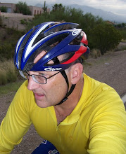
Susan, Larry, and Yours--heck, we rode 40 miles to the base from chez moi. 40 miles then the climb! How's that for mettle? Actually, we were really wanting to scout out the course--I wanted to show Susan what I thought would be the quickest route to the Catalina Hwy--so riders could get there straight-away and have more time to climb. I also had thoughts about which way to get everyone back as fast as possible. Larry came with and I'm glad he did because he seems to know every road in this city, and the milage.

Mt. Lemmon is about 30 miles due East of my place. This morning a lazy grey cloud hung on top. Because we may need some more milage--at least 125 miles to equal 200K, I suggest we add the Rancho Vistoso loop; its scenic, and we'll take Moore Rd as it has no traffic and is a straight shot to Rancho Vistoso. After part of the loop, we will take Oracle Rd South.

We are on our way. Susan says that Tucson is bike heaven. There are scores of cyclists out today--maybe part of GABA El Tour training rides.

This is Pusch Ridge. We're headed South on Rancho Vistoso Blvd.
We will ride down to Oracle and Rancho Vistoso Blvd where we'll stop at the Conoco for food, ice, water, and restrooms if needed. Then South to Oracle, and then a left onto Ina.
East on Ina, which will turn into Sunrise (this is my commute route Gentle Readers) and past Swan--all the way to Sabino Canyon Rd.

Visitor's Center at Sabino Canyon. There are restrooms and water here.

Susan and Larry at Sabino Canyon Rd and Synder Rd. Susan is recording the milage and checking her GPS.

Susan makes some calculations for the que sheet. 39 miles to the intersection of Tanke Verde and Catialina Hwy. We've stopped for a quick lunch, and I have to fix a flat on my front tire.

After a substancial climb up Oracle, Susan and I are pictured here at Oracle and Tangerine. We'll be heading West on Tangerine all the way back to the Bashas at Tangerine and Dove Mtn Blvd. That will be the fastest route back. It seems, from Larry's calculations, that taking the Rancho Vistoso Loop will actually add too many miles to the 200 km Brevet distance. We will ride Tangerine back, going due West, for about 8 miles. Tangerine is now about 70% bike lane. Since we'll be in a group, riding the rollers where there's not a bike lane should be pretty safe.

We're out of water so we make a quick stop at the Safeway on Tangerine. A kid had a this bike that he was pretty gangsta proud of--which looked like it was accessorized from his Grandma's old brass bed or something.

This is the light at Tangerine and Dove Mtn Blvd--where the "high end" Bashas is located. The Bashas over-charges all the old farts that live futher up in the more affluent gated communites. I never shop here. Its a total rip-off. I think the old farts know that too--the huge parking lot, which must be at least 10 acers--is pretty much empty all the time.
There's a Starbucks, and that's the real draw. The few times I've gone there for a coffee, most of the Bashas staff seem like they have nothing to do; they look awfully bored.
So we got this huge moster mega store which is really just a place to get a cup of coffee.
Throw another Pigmy Owl on the grill for me while you're at it, Mista Basha!
Rant is over! Cheers!
No comments:
Post a Comment