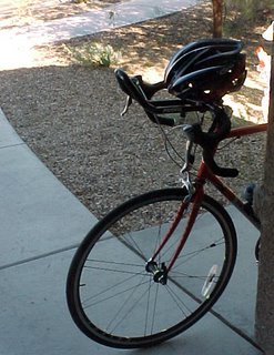
I've had this burning desire to traverse Park Line Rd, since last year's brevets. This Road is an East to West road that connects Interstate 10 to Hwy 79. Its just a road that has intrigued me because from the maps and satellite photos I've poured over while looking at brevet routes, there seems to be nothing out there but open desert.
Futher still, I often have talked to this old guy that comes into my library, and he's kind of a history and archeology buff. Much of the brevet route we take between Tucson and Casa Grande is the old stage coach line from the 1870s. I mentioned this Park Line Rd, and like the Ancient Mariner, he warned me to beware of this road and what I might find--drug dealers and other foes may use this area to plot their evil deeds, run guns, transport drugs, etc.
O! I can't wait for this adventure to begin!
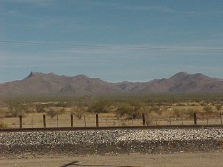
I'm right here at Tangerine Rd and the I-10 Frontage Rd. These are the Tortilita Mts and I live up there in a swank neighborhood called Dove Mountain! Called Dog Mountain by my jealous friends! Any way, this photo has me about 7 miles west of chez moi and I'm getting ready to head North on the Frontage Rd.
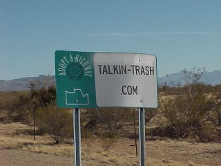
I went down a road called Missle Rd. because I'm not exactly sure where Park Line Rd really is--except that its a few miles North--or South of Red Rock, AZ. This sign greeted me after a few hundred yards. Maybe I'll explore this road some other time.
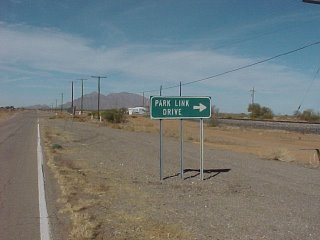
So here is the road sign. Funny but it was farther North than I thought.

Picacho Peak West on the other side of where I'm standing. The stage coach stop I'm told was right there at the Dairy Queen, then headed West on to San Fransisco. I've ridden 22 miles from Dove Mtn to this point.

18 miles! Hey that's not so bad, and this is the rigth road for sure.
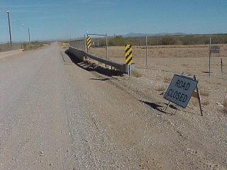
The point of no return, mes amis! And as I was putting the camera away, two State Troopers roared past very fast. A sign of things to come? Danger--or maybe Donuts--I guess I'm soon find out!
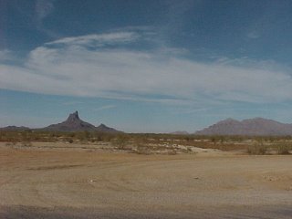
There is nothing out here... By the looks of it, major development will start around here. I road past hundreds of piles of bulldozed saguaro and Palo Verde and mesquite trees. It was a little sad really...
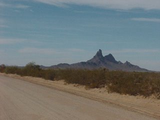
The desert out here is hot and dry, even in late December.
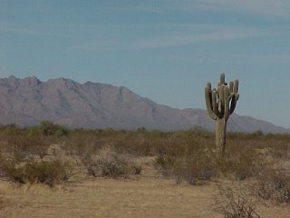
Only the occasional saguro...

But that changes soon. I actually start a gradual climb and I realize that I'm on the North side of the Tortilita Mts. It's still hot and dry, but there are hundreds of thousands of saguro as far as the eye can see!
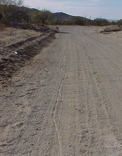
The dirt road seems to follow the natural curve of the land, and follows a wash. I had to dis-mount a few times when the road was too sandy.
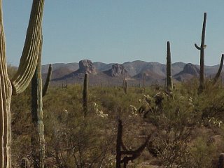
The other side of the Mountain. I believe that Owl Head Ranch is over by these huge rocks. You can't tell by the photos, but the desert out here is awesome, and the rock formations stately. As I continued East, and the the light changed, the two rock formations on the left start to look like two huge owl's ears, and it really does look like a gigantic owl's head--difficult to really get a good photo because the vegitation is so thick, and it seems the road pretty much is in a low-lying wash.
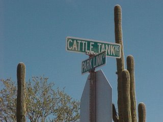
The road is still dirt, but now packed much harder. I can see signs of big construction trucks that have been on the move. Developement doesn't seem far away because the place is so beautiful. I must be getting close to Hwy 79.

This is looking South down Cattle Tank Rd. There's probably a major developement starting out this way. Next time I should ride down and see what's up. Maybe I'll find the secret Swedish Bikini Team training camp out here!
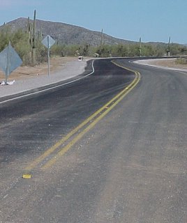
The start of the new paved road. This means that Hwy 79 can't be far--actually its 7 more miles!

Looking West on Park Line Rd., Picacho Peak is about 12 or 13 miles away. There is still nothing out here for miles. I've seen no ranches or houses whatsoever. Much of this land must be State Trust Land--for now.
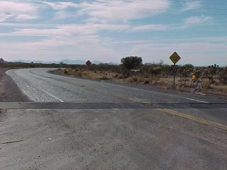
This is the end of Park Line Rd. I'm right here where it intersects Hwy 79. A sign at the cattle guard said paved road ends 7 miles. That last seven miles by the way was a pretty tough climb to this point.
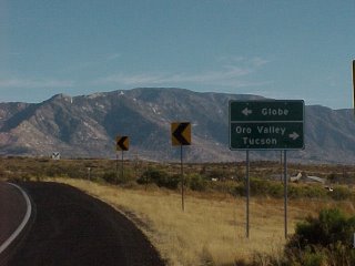
Mt Lemon is in the foreground. I know this stretch of road and now I have about 3o miles or more to ride back home. But what I forgot is that from here I have about another 8 mile climb--then a fast three mile down-hill to Hwy 77, which is Oracle Rd. Its windy and I'm pretty tired. Oh, and I've been fighting leg cramps--but I know I'll have a break going down to Rancho Vistoso, where I can ride faster...
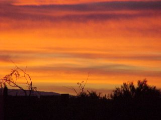
When you start late, you race the sun...
I'm glad I did this ride. I started too late in the morning--almost Noon, and rode thru the hottest part of the day. Luckily I brought my lights along just to be on the safe side. I'm also glad I did this ride in a clock-wise direction, other than counter-clockwise.
See, I picked up this supersticious thing about direction for the Lakota up in South Dakota. Everything is in a clockwise direction--that is the way the Earth is, and if you go counter-clock wise, it is bad luck. So even though I was never sure where Park Line Rd started from on the West side--and I knew where I would come out on the East side--it was still best for me to ride in a clockwise direction. Still a good choice because the 22 miles to the start from my house was all down-hill and I had the wind pushing me on the fronage road. Gentle Reader, too many times I have had to ride in the head wind on the I-10 frontage, and I must tell you it is relentless. Then I would have to have done a 8 mile climb up Tangerine Rd to my house. Again, this is a brutal climb after 50 or 60 miles on your legs with the headwind.
I did have the headwind going home, but again, I was going downhill and that gave me my chance to recover from all the climbing on the sandy dirt road of Park Line, and the next climb after that to Oracle.
In Rancho Vistoso, I had a flat, and that slowed my momentum a little--so I was pushing 5pm on the last five miles of my trip home.
Bike computer read 75.5 miles. A bit of a long ride for not have been in saddle for a few weeks. Maybe it was a little too long because I'm still a little sore--and the last few days I've felt a cold coming on. But I cooked steaks for us all and was able to go to bed by 9:30 that evening. O! that bed was so soft and warm!
Oh yeah, I took my arm warmers but some how I dropped them--so I paid a price to go to the other side of the mountain--to see those views and the great owl head, and the saguaro as far as you can see. Cool.
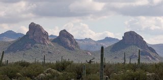
I got this picture from the web--the only one I could find in Google images. If you click on it you can see more detail in this great photo. The photographer has hiked in several more miles...
Well, back to the commutes for a time!
Merry Christmas and Happy New Year!
1 comment:
Bruce, excellent adventure. I have camped in this area. It is pristine desert and a real shame that it will soon be developed.
Ride on, ride safe.
Post a Comment